30 September 2020, NIICE Commentary 6072
Sudeeksha Kura
All of us are significantly exposed to dynamic progressive evolution but one major drawback we all let go of or consciously give in to is the harm these “progressive differences” have caused to our habitat. This reluctance unfolded unimaginable mishaps over decades and made us all more vulnerable to the crisis, both natural and human-induced. Ironically, disruptive technology, a major factor for the exorbitant progress, has helped in handling emergencies better especially through data.
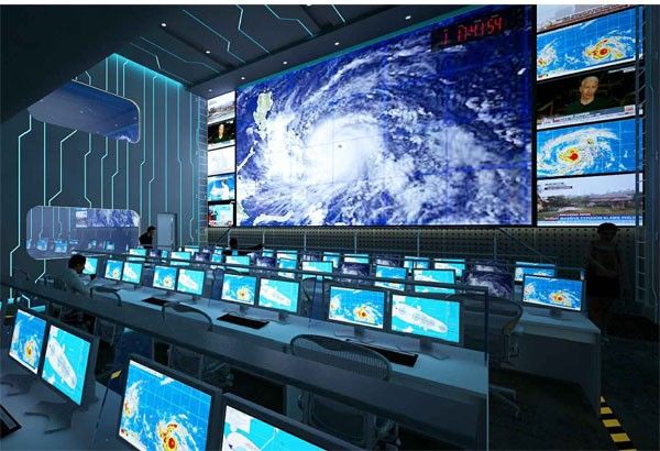
Traditionally, the four stages of disaster management, risk reduction, preparedness, response and recovery can use technology for efficiency. A well-known data intensive application, Sensor network having merits of low cost, quick response and stability and flexibility is used to monitor and reduce risks of disasters. Information collected by these networks is used to bolster community-based preparedness towards disaster management. After the disaster has occurred while the agencies conduct the response operations to confirm the whereabouts of impacted population, to establish and operate evacuation centres, to transport and manage relief funds, and to support victims information systems, enhancing situational awareness and decision making, play an essential role. Smaller, lighter, cheaper, and versatile unmanned aerial vehicles (UAV) have been usually positioned for aid delivery in inaccessible areas, real-time damage assessment and improving situation awareness through imaging and data acquisition. Data can be used not only in monitoring, detection, forecasting and prediction but also in post disaster coordination and response. Technology is potentially convenient and affordable for the disaster emergencies and crisis. Information technology is largely effective and also demonstrates the potential for integrating big data analytics.
The majority of information is gathered from social media followed by information and satellites, sensor web, IoT, crowdsourcing, UAVs, simulations, Lidar, spatial data, and mobile GPS. Social media is a powerful tool for disaster communications and can be used beyond raising public awareness and preparedness from surveillance, monitoring, providing real time alerts and warning and mobilising volunteers during crisis to enhancing recovery management. Social media allows emergency response crews to immediately connect with survivors and direct their attention accordingly. In the past, 20 million Hurricane Sandy related tweets were posted in two weeks and more than 7 million users near Nepal checked in via Facebook’s safety check after the devastating 2015 earthquake. It also facilitates supply of support and encourages donations. Most importantly it is the significantly useful for building trust and ensuring stress management through interactive platforms.
Enormous amount of data is collected from each disaster and this data is processed to build predictive algorithms surfacing hidden insights that enable smart disaster management. Data insights are made with precision starting from data exploration which involves investigating leads and trying to understand pattern or characteristics within data. Later, quantitative techniques are applied in order to get a level deeper by using various models with an intention to scientifically piece together a forensic view of what data is really saying. Data products like this can help respond quickly and effectively to the inevitable. An application of Data analytics is finding population based hotspots that is to reveal where the elderly and handicapped, the people in most need of rescue, are living using which the rescue workers will know where the most vulnerable groups are located. Google has been warning before disasters cause damage by providing public alerts in maps and search and spread information on how to stay safe. Lately Google has been using AI and significant computational power (a combination of machine learning, rainfall records, and flood simulations) to predict floods.
Predictive data analytics uses powerful algorithm models to analyse past data to predict future trends. Handful of emerging technologies like the Giants is helping to predict natural disasters. For example, National Center for Atmospheric Research developed a computer model to predict wildfire; this module simulates how weather drives fires and how fires create their own weather. The US Geological Survey is developing an Earthquake early warning system using a network of high quality ground motion sensors. For flood prediction scientists use radar, highly detailed computer model weather forecasts and advanced streamflow computer simulations to provide locally specific guidance for decision makers during the crucial one to twelve hour window. Usually in predictive analytics, geographical data, real-time images, recently generated evidence and knowledge of what rescue operators have access to are analysed to calculate the potential risks. A multi layered analysis is essential for natural disasters, there are numerous dangerous elements involved and missing out on any one can lead to a disaster.
To conclude, the major goals of disaster information system should be to improve decision-making before, during and after emergencies, through improved access to quality of information, to provide data products that are specifically designed to meet the needs of the users, to promote efficiency and cost effectiveness and to stimulate and facilitate mitigation.