05 September 2026, NIICE Commentary 12712
Aditi Soney
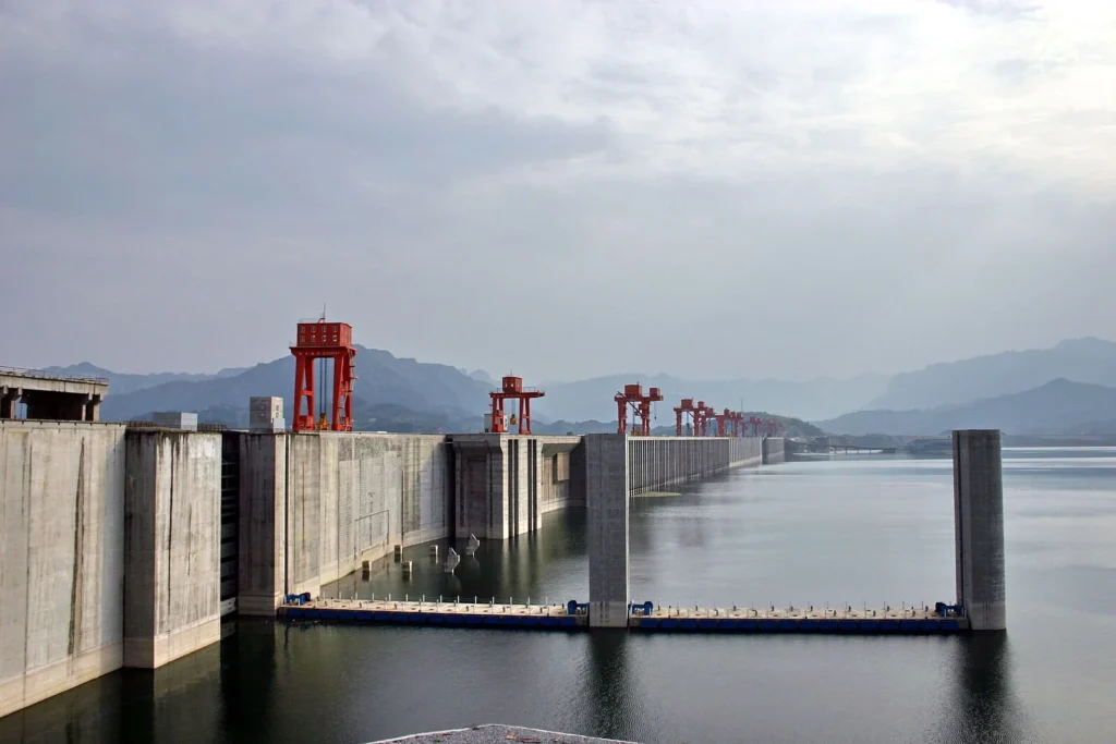
On 19 July 2025, China laid the foundation of the Medog Hydropower Station, a mega dam project over the Yarlung Tsangpo River (Siang/Brahmaputra in India). The dam is being constructed on the lower stretch of the river, located in Medog County, Tibet. India has perceived it as a major geopolitical as well as ecological risk, given that it is situated at a distance of just 50 km from the Indian state of Arunachal Pradesh.
Since its approval in Dec 2024, the project has received notable attention from both scholars and media houses, given the fact that it is a part of China’s border infrastructure projects. A Chinese scholar argues that “this project can not only accelerate the transformation of China’s green energy, upgrade Tibet’s infrastructure, but also strengthen the economic resilience of border areas.”
On the other hand, the majority of Indian scholarship views it as an attempt to weaponise water and establish dominance in terms of hydro politics given China’s status as an upper riparian state. The popular Brahma hypothesis (2011), which refers to the “position propagating that China could dry out India’s Northeast region through dam construction and water diversion while withholding sediment crucial for downstream floodplain formation.”, suggests the possible risks being perceived by India. However, Modak and Ghosh’s argument provides a scientific reality check. It points out how the real threat lies in the seismic fragility of the region and how the lack of data-based hypotheses is creating a political rift. Their argument is backed by empirical evidence, stating that it is not possible to alter the water levels & flow of sediments by building dams, as India’s geography can sustain the Brahmaputra system well on its own.
But the question is whether scientific reassurance & data based hypotheses can alter geopolitical responses? If yes, then why does the threat still feel so real, and why has India commissioned the construction of the Siang Upper Multipurpose Project (SUMP) by 2032, a year before Medog Hydro-power Station becomes functional? The answer lies not in facts but in how the facts have been perceived by both the states over time.
The Architecture of Mistrust
The India-China boundary disputes are rooted much deeper than mere dam construction. While on the surface, India cites concerns over ecological risks, its real concerns stem from the long-accumulated strategic differences. Currently, there is no formal treaty governing water sharing between the two states. The Expert Level Mechanism (ELM) signed in 2006 provided the foundation for the 2013 Memorandum of Understanding (MoU), which facilitated the sharing of basic hydrological data of the Yarlung Tsangpo River. However, China has always been reluctant to share transparent information, which became evident during the Doklam standoff (2017), when China cited technical reasons for not being able to share data, while sharing the same data with Bangladesh.
Soon after, the Galwan Valley clash of 2020 created a deep diplomatic rift between the two nations. With the expiration of the MoU in 2023, no formal arrangements have been made regarding water sharing and governance. This mistrust is amplified by China’s claims over India’s territories in Arunachal Pradesh, which are located quite close to the Medog Hydro-power project. India’s countermove of constructing SUMP is not merely an engineering upgrade, but rather a symbol of control over its territory. SUMP itself creates ecological vulnerabilities in many ways, but it aims to counter the threats posed by the Medog Hydro-power project. What makes it interesting is that the construction of the Upper Siang dam is seen as India’s attempt at territorial consolidation by Chinese scholars. While the dams may not pose actual political challenges and are limited to ecological vulnerability, the mere possibility of political implications makes the whole issue very contested. Practical decisions like the construction of a dam may be rooted in scientific analysis, but actual policy decisions are seldom based on pure empirical hypotheses. With a wide diplomatic gap between the two nations, any border infrastructure development by China will almost certainly be read by India as a threat to its sovereignty.
While many scholars suggest cooperation through measures like a strong institutional setup for basin-level governance, apart from having the occasional Memorandum of Understanding (MoU) with China, India should seek to develop with China and other countries a multilateral diplomatic agreement regarding the management of the Brahmaputra River to secure India’s vital interests at national and regional levels. However, the structural failure of hydro-diplomacy on the Brahmaputra is not accidental; it reflects a deeper political deadlock that neither side has an incentive to fully resolve. For China, meaningful institutional cooperation would require implicitly acknowledging India’s sovereign control over contested territories like Arunachal Pradesh. Smooth basin-level governance demands mutual recognition that Beijing is unwilling to extend. For India, the obstacle is not lack of willingness but lack of trust. China’s track record of selectively withholding data, breaking diplomatic arrangements, and using border infrastructure as leverage has made India a reluctant cooperator at best. Even in multilateral forums like BRICS and the SCO, India-China engagement remains conditional, agenda-bound, and incapable of bridging the fundamental diplomatic gap. The result is a purposeful status quo – non-binding MoUs that give both sides diplomatic cover without requiring either to make real concessions. The Brahmaputra remains ungoverned not because solutions are unavailable, but because the political cost of genuine cooperation currently outweighs the perceived benefit for both states.
Conclusion
The Brahmaputra’s future will not be decided by hydrology alone. The construction of the dam has begun, and more will follow; that much is certain. What remains uncertain is whether the politics surrounding the river can evolve faster than the infrastructure reshaping it. The solutions are not unknown: crisis-proof data sharing, trilateral engagement with Bangladesh, transparency in basin governance, and a shift from reactive dam-building to proactive diplomacy. But solutions mean little when the political will to implement them is absent. Perhaps the most overlooked entry point is the most obvious one — the people who live along the river’s banks, in Assam, in Arunachal, in Bangladesh, whose livelihoods depend not on which state controls the narrative, but on whether the water flows clean and predictable. If the welfare of the people is genuinely acknowledged, transparency in basin governance becomes not a diplomatic concession but a natural necessity. The Brahmaputra does not recognise borders. It is time the politics surrounding it started to reflect that.
Aditi Soney is a Research Intern at NIICE, currently pursuing her MA in Politics and International Relations at the Central University of Gujarat, India.